Tuesday, December 6, 2016

Day 14 – Mansonville, QUE, to Clyde Pond, VT

S-2016-9-3

Start: Mansonville,Quebec! 
End: Clyde Pond Campsite, just beyond Newport  

On the Way: Mansonville, The Grand Portage, Lake Memphremagog, Newport, Clyde River, Clyde Pond
Miles: 21.5 (Milepost: 270.5)
Map: 5, 6
Weather: Foggy in AM, burned off my 1100, nice and cool for Grand Portage!

Map 6: Mansonville, Que., to Bloomfield, VT/North Stratford, NH 

Trail Overview


O frabjous, momentous day!  Had a nice long sleep in my cozy Mansonville park spot, woke up to a little rain and fog (the beavers having behaved themselves and kept the noise down, I’m pleased to report), and had a nice smooth paddle out to Ch. Peabody on the North Branch of the Missiquoi.  On the way out of town, I passed lots of trees and fields draped in dew-encrusted spider-webs, which picked up the light in the soft gray mist.  It was quiet and Halloweeny and lovely.
Wonderful morning quiet at my parkside campsite.

The start of the Grand Portage.  (The not-so-grand prologue:
an undignified scramble up that riverbank on the left of the bridge...)

Once on Ch. Peabody, ‘twas time for one of the high points of the Trail: the Grand Portage!  It entailed 6.7 miles of first steady uphill, then steady down.  I used my new waist harness mechanism and draped my camp towel between me and the boat to minimize bruising (nothing visibly discolored yet) and set to.  By 1100 the fog had burned off and it was altogether quite a nice sunny stroll past some lovely farms, barring some taxing legwork on the uphills.  Consider this my leg day.  Can’t skip leg day.

Dieter and I both have our walkin' shoes on.

My newly-devised portage harness: a strap of webbing on the prow handle, long enough to wrap around my waist and loop around the handle again.  Towel added to stop boat from bashing against my hip.  Having hands free, especially for uphill hiking, made a world of difference.

0.7 miles from the end of the portage, I came across Jewett General Store, a little gem of a place that was hopping on a Saturday morning with tourists and locals alike.  And the reason was fresh-baked bread, straight from Owl’s Head, that same place in Mansonville I caught open last night.  I bought a loaf of fig and pistachio bread and a liter of 3.25% milk for the sheer novelty of it, sat outside on the porch bench and munched it down with some honey for lunch.  The road, which skirts Owl’s Head Mountain, is apparently a popular biking circuit, and I got to chat with some bikers from Montreal.  

Bread and honey and front porch sittin' for lunch.

An old-fashioned ice chest at Jewett's!
I had to get a liter (!) of 3.25% milk (!!) for the novelty of it.

Jewett's: that blessed oasis.

Lake Memphremagog is apparently quite a big Montreal vacation spot.  It spans the border vertically, making it really popular during Prohibition where it was a frozen highway from rumrunning into the States.  Divers have apparently found sunken cars with trunks full of moonshine on the bottom.  

The Lac, after a long hike.

Quebec folk don't mess around with their signs.

I was just about to leave when the friendly owner, who had just asked me if that was my kayak parked alongside the minivans, came out and saw me off with the gift of a fresh chocolate croissant!  Tell you what: those moments between him asking me “Do you like chocolate?” and disappearing into that magical store of his were some of the most wondrous and delightfully hopeful moments of my life.  It was the most perfect balance of chocolate and warm, oily break.  In a word, heavenly.  Lovely bit of trail magic.

Croissant!


I boogied on down the 13 miles of Lake Memphrenagog, came into Newport in the afternoon and checked in with customs via video phone (they didn’t even use the video: they just asked for my passport number, kept me on the line a while, then said I was free to go.  It was a bit of a let-down…), paddled the little drainage canal out of Newport, bypassed some low rapids at the mouth of the Clyde River (my pal for the next couple of days), and portaged past the last dam.  I’m now staying at an NFCT site tonight on Clyde Pond.  Just as I was pulling up, a daytripper was leaving with his river playboat atop his station wagon.  He’s apparently an NFCT maintainer for Vermont out for the weekend, and he asked if he could come back in the AM to interview me and take video of me shoving off for an NFCT promotional video.  I’m not usually fit to impress many people at that time of day, but that’s cool, I guess.

The Newport Customs check-in videophone.  Anticlimatic.

Newport waterfront: welcome back to Vermont.

Hammock hang with tarp on Clyde Pond.

[EDIT: Turns out his name is Joe, and he works for the AV department of Middlebury College, where one of my best friends went for undergrad!]

I’m pretty trepidacious of the 3+ miles of rapid-tracking I’m in for tomorrow morning.  If the water levels weren’t so low, I might just say eff it and portage around them…  But since the rapids will, in theory, be on the tame side anyway, might as well give them a fighting chance.

Bon voyage, Quebec.  Hello, more Vermont upriver malarkey.

Things Learned:

+ New portage method FTW!  Saved my hips and my legs on the Grand Portage.

+ Sea kayaking in Canada’s eastern fjords was recommended by a Montreal biker at Jewett’s.  Must add that to the Adventures-to-Investigate list. 

+ When 7 miles from the border, most places will accept US cash.  And speak fluent English.

Trail Magic:

+ The Grand Portage was the lovely stroll I needed in life! 


Petroglyphs along the Portage!  Apparently.  I would have walked right by had the guidebook not pointed them out.

A whole line of purportedly petroglyphed rocks...although admittedly I only saw the one marking I would believe to be human-made.

Idyllic country lane all the way down to the waterfront.  Gorgeous country.

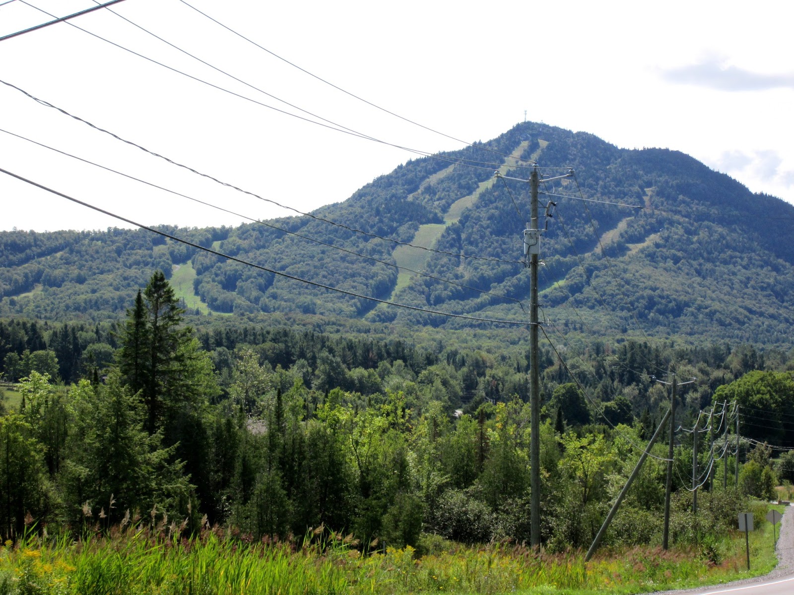
Owl's Head Mountain, which hosts a ski resort and looms over Memphremagog.

+ Magic surprise chocolate croissant.

+ Bowl full of blackberries picked from around the campsite for dessert!


Relaxing in no-sock weather...while I can.

+ I set an ambitious destination today…and I got there!  Hoorah!


+ Lots of trout swimming under me in the Clyde River, and saw lots of locals casting a line for them on the way out of Newport.

Monday, December 5, 2016

Day 13 – Stephens Mills, VT, to Mansonville, QUE

F-2016-9-2

Start: Stealth site ~4 mi before US/Canada border
End: Mansonville,Quebec! 

On the Way: Missiquoi River, North Branch Missisquoi River, Mansonville
Miles: ~18 (Milepost: 249)
Map: 5
Weather: Mostly clear, starting to feel like Fall

I have a bad tendency, when I find a real nice campsite, to get too comfy and oversleep.  Such was the case hanging in my cornfield last night in a newly warm, dry sleeping bag.  I slept in until the luxurious hour of 0900 before embarking on an altogether relaxed day.  (The water was so low and the opportunity to walk so frequent, there was no other way to take it besides “relaxed.”)


On the other side of that bridge: CANADA!

Today has also officially made this a trip abroad!  I passed into Canada at about noon.  For the sake of international brotherhood and cosmopolitan impartiality, I should say that the river on one side of the border is just as pleasant as the other, but in the case of the Missiquoi, it was like hitting a switch.  The river went from shallow and rocky and full of rapids and stupid little islands to wide and deep and predictable, through lots of cute farmlands.  And lots of paddlers: I must have seen five little groups of people out having a float and speaking French.  I only know of two outfitters around here, so going out for a paddle must be the thing to do here on a Friday night.


A French sign!  And a good example of the bilingual double-speak that is prevalent along this border.
Mansonville is quaint and timeless, as per most of these Trail towns.  I stopped by the famous Owl’s Head Boulangerie, the bakery whose wares are touted in every bit of NFCT literature I’ve come across, and got an absolutely divine cream-puff filled with Hazelnut ricotta and topped with honey and toasted almond slices.  The lady was just about to box it up for me when I told her no matter: it was not long for this world. She was happy to take US cash (with no exchange rate—I think that was her tax for taking the foreign currency…) and spoke completely natural English.  Then, two gents came in and she fluidly launched into a conversation in French!  It made my head spin and made me feel like a stupid tourist.  Ah, well, I’ll only be here two days, so I shouldn’t be too ashamed of my minimal international prep work.


Unnnng pastry.

[EDIT: From here on in, since the Canadian border was never far away, people were usually happy to accept US or Canadian cash.  Cards, not so much: If I were to repeat the journey, I’d definitely make sure to have an abundance of cash and some blank checks safely tucked away.]

My campsite tonight is a little back-path picnic table from the park where I put in in the AM.  I found a lovely hammock hang under some massive hemlocks (no need for the tarp!) overlooking a pool where some beavers have been splashing around…or maybe they were mink.  They sound remarkable, like a kid hurling a rock they can hardly lift into a still pond with a PLONK!  Here’s to hoping their Friday night party doesn’t go on until dawn…


My luxurious site, hidden away off the path with some falls and beaver pools right beyond that bank.

Put-in for the morning!
Things Learned:

+ The Canadian Border Patrol officer was CUUUUTE.  Maybe it was the all-back and Kevlar, or the slight accent, or the crisp black beard, or maybe just how little male company I’ve had lately.  But damn.

+ Today the boatsnacks plan backfired: the bags I had stowed behind my seat leaked.  The GORP was saved, but I need to devise a new method. [I ended up just sticking to a bar or two in my lifejacket vest, and saving the bagged snacks for when I had time to stop and unpack and take a lunch.]

+ For some parts of this bony Trail, using skirt and rudder are just hubris.  The rudder’s sure to drag and get damaged, while putting on the skirt is a waste of energy since I’m bound to soon just hop up again.  Instead I just have to sit in the cockpit, legs frying in the sun, with the bow painter draped back between my legs for easy grabbing.  Here’s hoping these hubris sections come and go quickly.

Trail Magic:

+ Beaver splashing, meeting a fat little Canadian groundhog along the road into Mansonville, and ample recycling and composting in this tiny little town.  A municipal wonder!

+ Saw the famous round barn in town, built by the Shakers so that the devil couldn’t hide in the corners.  Also had the clever design of a central grain chute, so all the cows in the bottom could face heads-in and warm up the upper floor with their body heat!

Day 12 – Enosburg Falls, VT, to Stevens Mills, VT

R-2016-9-1

Start: Lawyer’s Landing “Campsite”
End: Stealth site near first Mill Rapids right out of Richford.
On the Way: Enosburg, Missiquoi River, Richford
Miles: IDK, I’d have to look, but not very many…
Map: 5
Weather: Overcast, then sunny!


Map 5: Enosburg Falls, VT, to Mansonville, Que.
Trail Overview

Some cute river-side mushrooms.  The summer was ripe for mushrooms and, for some reason, spiders.
Webs were strewn from nearly every tree.
Stealth night #2—I’m having a rough string of campsite luck!  I know I should be saving my stealth kharma for later on, when the official campsites will be few and far-between, but I tried to make it to the Coonses’—an NFCT-friendly family homesite.  Honestly, I tried.  It was just on the verge of getting dark, and I was already kind of stumble-punchy from all the rapid-lining and sandbar-dragging I did today.  The Missiquoi, it turns out, continues to be bony, swift, and going the opposite direction from where I want to go.  That’s fine: it was here first.


In Richford, VT!  Where the Missiquoi was once powerful enough to run a fleet of mills and factories.
All the documentation and the nice NFCT rep I talked to on the phone today (called in to let them know that the Richford kiosk was out of sign-in sheets) made the Coons site seem super-obvious, but despite keeping a sharp eye out, I missed it.  I must have stumbled up and down this half-mile of bank three times looking for it, with my boat pulled up on a rocky shore.  Maybe I’ll look again in the light, just to be able to say I found it…

But yeah, lots of lining with more due ahead.  It’s how one deals with rapids, plus water moving too fast to paddle against, when going upstream, and there’s a lot of it in our future through Vermont, Quebec, and New Hampshire.  Then, in Maine, it’s sweet downstream.  Not that things won’t also be bony, but at least there will be no current to battle.  What’s more, they say campsites there are much more plentiful, meaning you don’t have to squat like a fugitive in a hammock in a cornfield like I am tonight.  (It’s not so bad: I found a little stand of trees that’s very in-grown from having all the fields around it constantly shorn, so this little red oak has quite the umbrella shape.)  Plus in Maine, the bodies of water are larger, so you change less frequently, so fewer carries!  All the guidebooks have got me anticipating it like it’s the Big Rock Candy Mountain or something.

Teton was taking a long time getting started at Lawyer’s Landing this morning, so I left.  Sun’s up, I’m paddling, as long as it’s warm enough.  I hope he isn’t feeling ditched.  I don’t want to make him feel bad, but we did both set out to do this trail solo, and I don’t want to impose.  Solo paddling is nice, granted, but camping alone gets old.  Which is why I’m so pissed about missing the Coons!  It would have been a nice change to interact with a genuine Trail family.

Tomorrow, I venture into Canada for the first time!

Things Learned:

+ Lining is a skill, like any other.  I’m getting better at it, endurance-wise, but it’s still a good idea to stop for the evening when I’m starting to feel stumble-drunk, for safety’s sake.

+ Dieter das Boot WILL swamp if broadsided in a rapid, it turns out.

+ People are bad at signage ‘round here.  But they do try.

Trail Magic:

+ Saw a ~14 inch snapping turtle on the muddy river bottom in the farmlands right past Enosburg.  Made me feel real confident about trudging through the mud when the boat gets stuck…

+ Took a long lunch when I got to the lovely Davis Park in Richford.  Spread out my soaked sleeping bag and gear in the sunny grass and FINALLY got it all to dry!  Gotta love space-age synthetics.  Also got to have a nice chat with the owner of the lovely Gray Gables B&B, who is a Boston native, a fine fellow, and a friend of the Trail.


The Gray Gables.  Some NFCT paddlers make a point to stay here.  I was too smelly and unkempt at this point to even consider venturing into a house so nice.


The Great Gear-drying Shakeout at Davis Park.
+ Richford also had a supermarket, so I stocked up on olive oil, noodles, boat snacks, and non-caffeinated tea so I can have a hot cuppa before bed.  I parked the kayak on its wheels in one of the parking spaces and got lots of great side-glances.

Day 11 – East Highgate, VT, to Enosburg Falls, VT

W-2016-8-31

Start: Stealth site just beyond East Highgate, VT
End: Lawyer’s Landing in Enosburg Falls, VT

On the Way:  Missisquoi River, Enosburg
Miles: ~20 (Milepost: 211.5)
Map: 4
Weather: Remember how I said rain was threatening overnight?  Well, it woke me up and will put me to sleep.  I did ask for rain…  Repeatedly…


In Enosburg, near the end of Map 4 and my first segment of Vermont paddling.

I be there.
I was so zonked last night, sleeping in the open on a mid-river rock, such that I didn’t wake up until the rainstorm has soaked through my sleeping bag.  By that point, it was almost dawn, so I thought I’d just pack up and get underway.  It sprinkled throughout the day while I fought my upstream battles with the Missiquoi whitewater and flatwater.  That was fine: I was already wet, and the more rain we get now, the less scratchy the next couple of days’ paddling will be (my eternal, placating mantra).  But then, I very stupidly went for a town break when I finally got to Enosburg Falls, leaving my sleeping bag to “air out” on a fence post at the put-in.  It was still a bit damp, since I had gotten most of the morning rainwater to evaporate out by lashing the open bag atop the kayak during a nice four-mile portage (along a rail trail past some bony rapids, which was the most deluxe portage route I’ve had to far—and with more trail-side apples!). 


The Enosburg Falls Bridge of Lights and Flowers.  Essentially, an old sand-filled bridge (which was some cool engineering) turned into a garden/sitting area.

Paddling up that last bit of dam run-off was fun...
All drying efforts were in vain, it turns out: while I was in the Enosburg library, doing my thang and checking email, the downpour began.  I waited out the worst of it, then trudged dejectedly back to the “campsite.”  (While I appreciate the NFCT’s efforts to give us something—anything—as far as camping space goes, “Lawyer’s Landing” lies as much as its namesake, and is not so much a campsite as a buggy, mown lot with bad drainage.)  I waited under the bridge next to the dam like a troll, not brave enough to sit on the moldy futon the local kids had stashed there for their canoodling, contemplating spending the night under there and wondering if I would encounter the owner of the bottles and ratty blankets if I did. 


The new bridge that replaced the Bridge of Lights and Flowers...and kept me somewhat dry during that afternoon's downpour.
When the rain let up, it was half-an-hour to sunset, so my original plan of dashing down the river to find a comfier field to sleep in was shot.  I set up my sad little tarp on the only feasible uprights around—a corner of a split-rail fence—and put my groundcover and soaked sleeping bag underneath it.  Then Teton showed up, having survived the lightning on the water!  He also called it a day, but could opt for higher ground in his free-standing tent.
I ventured into town to try and dry the bag at the laundromat, but once again, the laundry gods thwarted my plans.  It was closed.  At 1730.  Gotta love these small towns.  In consolation I bought dinner at literally the only place still open, since even the pub had shut down at 1900: a greasy Chinese takeout diner. 

Things Learned:

+ Greasy Chinese food tastes great in crises.  And that deep-fried egg concoction will be the only fuel keeping me warm in my soaked bag tonight.

+ If there’s ONE item of gear to keep dry, it’s your sleeping bag, with camp clothes inside.  Period.  I feel like a moron for compromising that one rule of camping survival.  It’s not cold enough for this mistake to be dangerous, but damn is it uncomfortable.

Trail Magic:

+ More tasty apples along the rail trail, and my portage drying service kind of worked  A method to keep in mind for the future.

+ This campsite’s kind of sketch.  I’d be less afraid if we didn’t have a farm with an angry, loud dog on one side and a bridge overhang with obvious signs of regular occupants on the other, all cordoned off by a fairly busy country highway.  Tomorrow I escape river-ward, the only direction left to go.

+ On to Map 5!

Day 10 – North Hero Island State Park, VT, to East Highgate, VT

T-2016-8-30

Start: North Hero Island
End: Stealth site just beyond East Highgate, VT
On the Way:  North Hero, Missisquoi River, Swanton
Miles: ~26 (Milepost: 196.5.  So close!)
Map: 4
Weather: Sunny in AM, then overcast.  Would love some rain, but not overnight…

In lieu of NOT being able to report 200 miles down, harrumph, I instead report on my first stealth camping adventure.  It’s private land as far as the eye can see for most of Vermont and Quebec, and in one of those two landmasses I can get caught and tried without an embassy getting involved, so here I am.


Home sweet...rock mound.

It’s quite nice, as far as initial ventures go.  I pulled over to a mound of rocks, peeked over the bank and saw that the other side is just a remote hayfield, found a nice fold of rock to fit my back (just like we just to camp on Big Rock at Camp Redwing!), took a riverbath and washed out the river clothes, made dinner, and kept the headlamp beam under my shirt.  Not too bad, and I got to paddle from dawn to dusk and put some serious miles on, which feels great.


Gorgeous old ironwork on a bridge next to one of the many dam crossings.


The dam was inflatable!  It had this big rubber bladder that kept back the water along the top.
Very impressive engineering.

The bony Missiquoi River


Today I also lined up my first rapid, since this marks the upstream portion of the trail where rapids become climbs rather than drops.  It was right near the scary old remains of the Highgate Dam, and I had just worked up the courage to ask the landowner if I could venture across their river-ride yard with angry “NO TRESPASSING” signs every five feet.  It was a put-in right below the last ledge of the rapids, and to put in any higher upriver would entail an awful dirt road portage and a hand carry…

So I said eff it and walked the boat up through the rapids in the dying light.  Wasn’t that hard, and managed to fall only after the rapid was over.  Made me feel super-human, scaling upriver.  Good thing there will be plenty more of that to come…

Things Learned:

+ Ignore it long enough, and that right shoulder knot becomes a right bicep pain…  NO BUENO.

+ Green algae, when it gets under my clothes, makes me itch real bad.  Not a good sensation when 80% of your body is securely and carefully tucked into boat and skirt and lifejacket foam, far from the prying fingertips with their relief-granting nails.

Trail Magic:

+ Wild grapes, raspberries, and blackberries along the portage!

+ This morning saw me going through a heron rookery at the mouth of the Missiquoi!  Didn’t get to see as many as I had hoped, even though I made sure to get there early, but still saw lots of birds and a couple birders.

+ Had two slices of really fabulous cheese pizza, some chocolate milk, and a popsicle in Swanton, while taking a break from hauling up over two too-damned dams.

+ Here at the stealth site, I’ve seen four beavers playing in the rapids (one slapped at me!) king fishers, and maybe raccoons before the night is out, judging by all the scat around the rocks.

[EDIT: The raccoons stayed well enough away, but I did make a point of hollering into the brush whenever I was awoken by a rustling sound in the night…]

Friday, December 2, 2016

Day 9 – Cumberland Bay State Park, NY, to North Hero State Park, VT

M-2016-8-29

Start: Cumberland Bay State Park
End: North Hero State Park on Lake Champlain, Stephenson’s Point
On the Way:  Plattsburgh, Cumberland Bay, Lake Champlain, “The Gut,” North Hero
Miles: 22 (Milepost: 170.5.  Neeeeew State!)
Map: 4
Weather: Overcast, then clear, nice and warm.


Crossing from Plattsburg to North Hero involves dodging this
massive ferry boat every half-hour.
NEW STATE!  Reporting from Terra Firma in our second of five states, Vermont.  It’s been 22 miles of paddling the mighty Bitabawgok, against the wind with large waves in pea-green-soup algea-infested waters…  But I’ve loved it.  It feels great to be pushing water again after my hiatus, and any water where one can freely move feels like good water now that I’ve seen the dry and bony alternative.  Like my pal Teton says: at least on a land-based journey, like the AT, the trail will always there, regardless of weather.  With rivers, so highly dependent on rainfall, not so much.  Here’s to the next bit of paddling tomorrow, and may it not be our last to come in a while as we face the Missiquoi.

Enjoying the open water in the morning before the big waves pick up in the afternoon.
Lovely house with its own lighthouse on the banks of Bitabawgok.
Today, with its long stints of heavy paddling, was a great day for brainstorming.  I thought up some Warrior Bunny concepts, which I should sketch up and send along to Carl and Co. along with a request for the cast list and an inquiry about hair and makeup.  I should also follow up on that HUB theater gig…  It’ll be a busy October, but aren’t they always?

[NOTE: In one of my professional lives, I’m a freelance costume designer.  Planet of the Warrior Bunnies was the first show I had lined up for my return, which was miraculously pulled off in about three weeks.  I’m still marveling that it happened.  Some thanks, I suppose, to this planning ahead courtesy of old Bitabawgok.]

This campsite’s lovely, on an island right south of our jumping-off point from the Lake to the Missiquoi River.  By nature of our West-to-East trail, we hardly ever get to face the sunset (plus we get some great south-arm-only tans, which is fun).  Tonight, however, here at North Hero Island, is a rare and exquisite exception, since we’re right at the tip and have a nice expanse of lake to the west.  There’s no one else here except me, Teton, and an older fellow named Ernie who’s an organic farmer from New Jersey, plus hundreds of bright green-and-black little frogs.  As you walk through the weeds and rocky beach around the shore, they hop away and make the path in front of you look like popcorn.  Also lots of raccoons, as evidenced by the heaps of pried-open mussel shells along the shore.  Although I don’t know: maybe the birds here are clever enough for that party trick, too.  It’s too dark to search for a shell and check for claw-marks.


A Shepardson's Point sunset on a froggy beach.
Things Learned:

+ Post drops are as much for getting rid of things as gaining them.  I’m down to three dry bags of gear, which means I can stash my wheels in a hatch and cut down on wind drag where it might make a difference (AKA, lakes)!

Trail Magic:

+ PO Transaction went smoothly—only made a minor mess of river water on the floor, and no one though ill of me for doing a gear and food shake-out on the address-writing table.

+ Got to look at Ernie’s LLC paddling (that’s the Lake Champlain Committee) guidebook.  He’s been coming back to this lake for 19 years’ worth of vacation and still has new places to explore!  He says the cliffs and finger-like fjords to the south have been the most exciting.  He also scoffed when I asked him if he’s spotted Champ the Lakemonster yet.

+ Great lakeside hammock hang with a strong breeze—no need for the bug net!
Right on the edge of the beach.  Falling asleep to waves is what is best in life.