Showing posts with label Map 9. Show all posts

Saturday, March 18, 2017

Day 27 – Spencer Stream, ME, to Spencer Lake, ME

F-2016-9-16

Start: Start of Spencer Stream, Unofficial campsite
End: Stealth camp on shore of Spencer Lake, about ¼ mi from put-in.  In other words, the end of Spencer Stream, may it rest in hell.
On the Way:  Spencer Stream, Spencer Lake
Miles: IDK, about 8.  Grrr.  Milepost: ~486.
Map: 9, 10
Weather: All clear

Map 10: Spencer Stream to Moosehead Lake, ME

Trail Overview

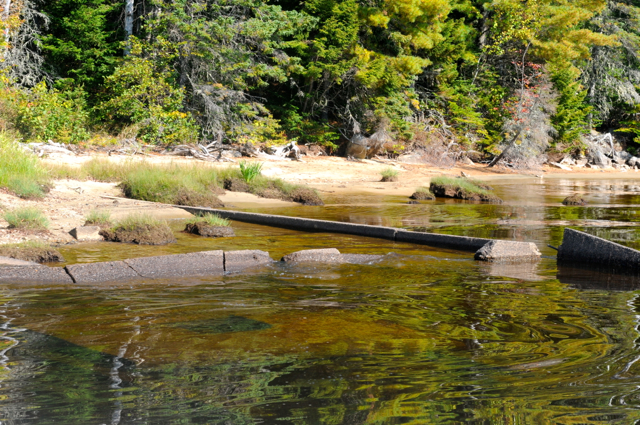
Alas and Alack!  Woe and Tragedy!  I seem to have lost The Book.  As if I needed to have any more reason to hate Spencer Stream, which was 6 miles of boulder fields and downed trees that, by the end, I was bull-moosing my way through, dragging Dieter across the rocks instead of navigating them with any sort of strategy.  I usually keep The Book strapped under my front deck elastic, wrapped in 2 sealed Ziplocs, ready to be consulted at a moment’s notice.  And I did consult it: I remember pulling it out for a look today at about 1130.  After that, I don’t recall using it, and only noticing it was missing during my evening gear shake-out.  In the morning, I’ll paddle back the ¼ mile to the horrendous dam I pulled over last and see if I left it there.  If not, I’ll consider it lost to the grabby dead tree-fingers of Spencer Stream, because there’s no way in hell I’m back-tracking there.  Maybe someone will find its pulpy remains during the Spring Thaw.


Goodnight, Sweet Prince.

What will we do without the book?  Make do with the impotent-by-comparison official guide, I guess, and see if I can buy or scan a copy in Jackman, or look up all the Trail updates at once.  But I so liked my copy.  I was keeping notes and updates to send along to Katina…  It was so useful, and the official guidebooks and maps are so obtuse by comparison.
I hate losing important things, both on and off the Trail.  Every now and then, I just get stuck in a rut of mindlessly misplacing important tools for maintaining a responsible life, and there’s nothing that makes me feel more incompetent.  First the paddling gloves, then one of the cotter pins from my wheels (fortunately I have two spares), and now of all thing my Beloved Book of Beta.  I tried doing my beta reading with the official book tonight.  I didn’t even know if it was describing the Trail or a side trip!  It’s so unfriendly for through-paddlers.  At least they point out the map updates: I guess that’s the only critical part of wisdom needed beyond the route.

Summary of the day: I look a late morning to go check out the Hut.  It was as expected.  I bought a $1 muffin and looked up some lyrics I’d been forgetting in their folksong book.  I spent most of the day trudging up 6 miles of a rocky stream, which very possibly might have cost me my guidebook.  I hauled my boat up and over a 8’ rocky ledge with minimal damage.  I made some sumptuous mac-n-cheese with carrots and finished a bag of candy corn to make myself feel better.


The Grand Falls Hut, part of the Maine Huts and Trails system.  It was pretty lush.  Via MaineTravelMaven.com
Pretty damn lush. Via NewEnglandRambler.wordpress.com .
I miss my Book.

Things Learned: 

+ Never again, Spencer Stream.

+ Trying out sleeping with my neoprene socks on.  Feet pretty sweaty already.

Trail Magic: 

+ Folksong book at the Great Falls Hut.  I revised some lyrics, as well as adding some fresh ones, in my internal jukebox.

+ Loons and Beavers carrying on here in Spencer Lake as I drop off to sleep…

My view from my hammock.  Besides one house across the lake, I couldn't see a soul, which is the idea for stealth camping.
The hammock setup.  Had to search quite a bit for some birches that didn't bend in a worrisome manner under the weight of the hammock.
[NOTE- I found out later in Jackman that right across the Lake from where I stealthed was a WWII POW camp for German troops captured in North Africa (AKA, Rommel’s men).  I’m glad I learned that in retrospect—otherwise between the full moon and the wind and my overactive imagination I would have never gotten to sleep.]

Day 26 – Flagstaff Lake, ME, to Spencer Stream, ME

R-2016-9-15 

Start: Campsite on Flagstaff Lake
End: Put-in at the start of Spencer Stream.  There’s a picnic table and fire ring and “no camping” signs everywhere.  I think I’m fine on account of it being the Thursday after Labor Day and being in the middle of snowmobiling trails, but I pitched my tarp in the woods and covered Dieter in brush, just to be safe.
Map: 9
On the Way:  Flagstaff Lake, Long Falls Dam, Dead River, Grand Falls, Spencer Stream
Miles: 20.5.  Milepost: 478.5.  At least 5/8 done!
Weather:  A bit cloudy in the AM, all clear now!

Hard to imagine that I’ll be at my last Post-Drop, in Jackman, ME, in less than 2 days.  I’ll be able to dump some of the stuff that’s no longer useful, like my dead camera, and get some really cozy clothes.  Also, don’t know how to where but I’ve managed to lose my nice ½ finger paddling gloves.  Guess there’s no time like now for getting some quality paddling calluses.  I also have some full neoprene gloves in my box that would do, if a little overkill.

Today’s paddle was one of the first where I didn’t see another living soul.  Maybe the first?  I haven’t been keeping track, and it frankly didn’t even occur to me until I stopped to think about it.  Let’s hope it stays that way, rather than ruining the tranquility with a chewing-out and a forced move from a hut warden.  I think the reason they’re so uppity about the camping is that about a mile away, there’s a snazzy hut run by the Main Huts and Trails system.  It sounds great on paper: It’s a cabin with bunkrooms and showers and dinner and breakfast included, plus booze and desserts for sale.  It’s like a modern-day answer to the Sport Camps of old.  In practice, I’ve been told it’s $95/night.  Yowza.  I could stay in a hotel all weekend for that.  I guess it’s the location, and an example of scarcity economics in action.  But I’m curious: I might stroll down there in the morning and see if I can snag some breakfast leftovers or coffee and see the place.  I’ll have to lie and say I stayed along the Spencer Stream, though, and not this nest of notoriety and stern signage that I’m currently occupying.

I’m sooo rich in food right now.  No more buying: It’ll be an exercise in using what I have.  Plus it’s sooo heavy.  Gotta learn to lighten up for future backpacking.

Things Learned: 

+ Don’t stuff yourself at lunchtime.  No matter how tasty those sesame sticks are, it leads to some indigestive paddling.

+ Grand Falls.  They were Grand.


Grand Falls.  They were Grand.  They're not the tallest falls on the Trail: Allagash Falls are 40 feet tall, which these are 30.  But they're still pretty spectacular.

Trail Magic: 

+ Lovely patch of whitewater coming on to the Dead River!  It was a nice chute, followed up by six miles of wide and glassy quickwater.  Really nice.

+ LAST BIT of upstream paddle tomorrow!  Well, last significant bit.  Hoo-rah. 

Day 25 – Rangely, ME, to Flagstaff Lake, ME

W-2016-9-14

Start: ME Forestry Museum outside Rangeley
End: Campsite on site of Old Flagstaff Village, on Flagstaff Lake
On the Way:  South Branch Dead River (Not), Flagstaff/Eustis/Stratton, Flagstaff Lake
Miles: 29.5!  Milestone: 458
Map: 9
Weather:  Really bizarre: cloudy with sunshowers, then cloudy with lots of dramatic sun rays and the Bigelow mountains covered in fog, then dark and ominous until nightfall.  Probably rain overnight—fingers crossed!

[EDIT: This portage actually shakes out to ~18.4 mi., according to Google Maps.  So no jaunt, but 6 mi shorter than what the guidebook says.]

Damn!  One day I beat myself up because I can’t get out of bed on time, then the next day I do things that are, quite frankly, rather super-heroic.  It’s a roller coaster for Rosser’s ego on this Trail.

I knew today would be about walking up Route 16 to bypass the woebegottenly low South Dead River.  I read that it was ~22.5 miles by road.  My only real reference for how much I can walk in a day is from hiking in the Whites, which involves significantly more elevation delta than this road.  There, 22.5 miles will be do-able, but only if you can spend the evening wallowing in a state of exhaustion.  Part of me doesn’t entirely trust that figure for the distance I had to walk—another part wants the first part to shut up and accept that when I tell myself “walk until you know no more,” I can accomplish incredible things.


The Longest Portage of the Trail.  If the other one is the "Grand Portage," this one is "Le Portage du Suckage."
Anyway, suffice it to say that I was expecting to be stealthing along the road tonight—instead, I started my hike at about 0700, rolled into town at about 1300, restocked in this very Trail-friendly town (the AT also crosses here before heading into the Bigelow Range), and had a gas-station-gourmet lunch.  It featured a sandwich, home-made chips, and a cheesecake/cookie monstrosity that must have been ¼ a tray and immeasurable calories for $2.75.  I was considering investing in a few.  A retirement fund comprising entirely brownies is a good plan, right?  After that decadence, I walked back to my boat, meeting an AT hiker along the way who offered me a beer with his zero-day buddies.  The idea was tempting, as was commandeering their shower, but I wanted to press on for a couple miles on Flaggstaff Lake through the eerie, stormy twilight.

Flagstaff itself is a cool town.  It’s actually an amalgamation of the former townships of Stratton/Eustis/Flagstaff Lake, and is listed accordingly on the sign that greets you at the top of Rt.16.  The original Flagstaff got its name when Benedict Arnold passed through with troops and left a flag posted, which was later found by settlers.  Then in the ‘50s, the Dead River was dammed and the three little valley villages were flooded to create the lake and facilitate log driving.  (Then, ironically, the lumber industry dried up about a decade later.)  The current town is kind of an average of the previous three towns’ locations (town-bar, if you will).


Foundation of a barn flooded to form Flagstaff Lake.  Not at all creepy.  Via MaineTravelMaven.com

I’m actually camping near where the site of the ACTUAL Flagstaff Village used to be, specifically the schoolhouse.  It’s spooky, but I’m pretty sure most of this ambiance comes from the weird cloudy pallor of the evening, plus hearing the lake splashing, plus the wind, plus being alone.  Well, alone except for the three little field mice playing chicken with my food bag.  I shared some of my dinner with them, and now they’re rather emboldened.  As long as they stay off my face while I sleep, we can be buddies.

Things Learned: 

+ After this latest instance of hungry food-shopping, I have enough grub to last me at least until Allagash.  No more buying food.  Please.  My bag will barely shut.

Trail Magic:

+ 2 cars stopped to offer me water during my trek on Rt 16.  They didn’t press me to accept a ride, though, which was a nice change.  It means they’ve encountered enough stubborn through-paddlers on the route to respect the need to be self-propelled.

Day 24 - Mooselookmeguntic Lake, ME, to Rangely, ME

T-2016-9-13

Start: Students Island on Mooslookmeguntic
End: Maine Forestry Museum Lean-to (“The Halfway Hilton,” it’s named, which was cute enough to convince me to end my day early and stay.)
On the Way:  Mooselookmeguntic Lake, Students Island, Oquossoc, Rangeley Lake, Rangeley, Haley Pond, Gull Stream
Miles: 23.  Not bad.  Milepost: 428.5!
Map: 8, 9
Weather:  Clear, little windy.

Map 9: Rangely to Spencer Stream, ME
Trail Overview

A lovely day full of giant lakes, which are easily my favorite medium of this trip.  And, I hate to day it, the last day of them for quite some time…  Ahead lies the South Dead River, which, completely faithful to its name, is dead for nearly every paddler from early June onwards.  “Ancient waterway” my ass.  Well, to be fair, the ancients probably didn’t see as many extreme weather years as we post-Industrial Revolution folk have brought upon ourselves.  Still, I chatted with a guy who works with hydro plants at the Oquossoc grocery store, and he said this was the worst year for rain in 6 or 7 years.  My timing.  It’s fabulous.


So next is lots if portaging along Route 16.  24.5 miles of it, according to The Book.  Gonna tackle it first things in the AM, which I should be more vigilant about taking advantage of.  I get too comfy in my hammock, and then I’m not up until 0800.  Days are getting shorter.  Have to use all of them.

The Rangely Lakes Region Logging Museum.  Wasn't nobody around when I rolled in for the evening, and left in the early morning, but the giant sheds were full of antique logging equipments, chainsaws, and other fun toys.  I didn't get to see this kind of excitement...

I was planning on being 2.5 miles into the portage tonight when I passed this “Hilton” lean-to that the Forestry Museum folks built.  The home-routed sign, the lovingly cleared little bluff above Gull Stream, all the cleared pine wood rotting for want of being burned, the fresh evergreen branches someone has stuffed in the lean-to chinks for air freshener—these element all conspired to get me to call it a day at 1700 and stay the night.  As soon as I had made the decision and was moving down the trail to stash my boat behind the Museum, two young Belgian men, probably younger than me, asked if they could camp out, too.  They seemed harmless, so I said sure.  They were appreciative: they told me that, for want of camping spots, they had been spending the night in their two-seater yellow Mustang rental car.  Yipes.  It’s past dark as I write this and they’re not back from their grocery run, so perhaps their plans changed.  I have a campfire going and plenty of wood standing by, figuring they’ll like the full camping experience.  If they come rustling in like varmits in the middle of the night, I’m going to be perturbed.


The cozy "Halfway Hilton," with plentiful logs and fresh pine boughs lying around (thank you, logging museum).
[They ended up being total gents, and lots of fun to talk to.  They’d been touring the Northeast for a short holiday, flying into Boston, and with plans to hike a bit in the White Mountains.  I was excited to tell them my favorite trails.  They also had taken a jog to the Harvard Coliseum, and were amused to hear that I live right across the river.]

Things Learned:

+ Groceries should be bought when the chance presents itself.  There ain’t no time for 2 shopping trips.  I passed on oats and carrots in the Oquossoc grocery, thinking they’d be cheaper at Rangely’s IGA.  IGA turned out to be a couple miles from the Trail.  Eit!

Trail Magic: 

+ Upon hearing this, the owner of Ecopelagion (the cutest and most friendly outfitter I’ve visited yet) gives me the Instant Oats right out of her own pantry!  She was entirely too night.

+ Lit a fire tonight with just a touch of the lighter.  Might have been all the dry, pitchy pine, but I like to think it’s because I’m a wizard.

+ I saw Katina Daanen’s name in the Forestry Museum register!  She’s the writer of The Book (the one I like), and apparently was visiting on a side trip from the AT.  Talk about a badass.

I fangirled hard enough to pull out the cell phone and use some of its precious juice to get a picture.

+ This is the start of the NFCT’s overlap with the AT, so saw some through-hikers in town.  For once I’m not the scraggliest character, and I know the library is comfortable with smelly denizens.  I also feel kind of ostracized by this: when I was picking up a sandwich in the gas station, the cashier offers the motley group of people nearby (me and three hikers) the old sandwiches for free.  There were four sandwiches, but the hikers swooped in and grabbed them all.  I know I’m not on as epic of a quest as those guys, and I probably don’t look quite so buff and grizzly as a result, but still: I’m roughing it, too.  Frowny moment.